


-
Sale
 The Only Thing Worth Dying For: How Eleven Green Berets Fought for a New Afghanistan (P.S.)On a moonless night just weeks after September 11, 2001, a U.S. Special Forces team of Green Berets known as ODA 574 infiltrated the mountains of southern Afghanistan with a seemingly impossible mission: to foment a tribal revolt and force the Taliban to surrender. Armed solely with the equipment t...$6.00$15.99
 -
Sale
 The Boat Galley Cookbook: 800 Everyday Recipes and Essential Tips for Cooking AboardNo matter what anyone tells you, boat cooking IS different from cooking ashore. The space is smaller, there’s no grocery store 5 minutes away, you have fewer prepared foods and electric appliances, and food storage is much different. Despite cruising different oceans, we―Jan and Carolyn--both faced...$24.35$40.00
 -
Sale
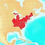
 Navionics Hotmaps Platinum East Lake Fishing MapsThe Navionics Hotmaps Platinum East Lake Fishing Maps gives you detailed maps of lakes in your region with SonarCharts and Community Edits, plus Satellite Overlay, 3D view, panoramic lake photos and exclusive one foot contours on high definition lakes. Spend less time searching and more time fishing...$169.41$199.00
 -
 Extreme Marine Products Arnall's Standard Arch Support System for Pontoon Covers - Stainless SteelYour purchase includes 4 Sets of Standard Arch Support Brackets (8 pieces). This is the base level design for little to no inclement weather. This is one of our best selling products, with thousands of users across the US. This product is made in the USA out of zinc plated steel with an aluminum bra...$69.99$69.99
 -
Sale
 Davis Instruments International Nav Rules Quick Reference CardA comprehensive guide incorporating the International Maritime Buoyage System and COLREGS. Clarifies differences between Cardinal and Lateral buoyage systems and buoyage regions, key to reducing confusion and danger when entering unfamiliar waters or busy harbors. Complete details on right-of-way, s...$9.94$9.99
 -
Sale
 The Cruising Guide to Central and Southern California: Golden Gate to Ensenada, Mexico, Including the Offshore IslandsComprehensive and authoritative, this guide combines and updates two smaller, long-trusted regional books to provide seamless coverage of the entire California coast from just outside the Golden Gate Bridge to Mexico, with special attention given to the popular offshore islands between Point Concept...$19.33$32.00
 -
 WD-40 110174 Multi-Use Product Non-Aerosol Trigger Pro, 20 oz. (Pack of 1)BRAND STORYIn 1953, in a small lab in San Diego, California, the fledgling Rocket Chemical Company and its staff of three set out to create a line of rust-prevention solvents and degreasers for use in the aerospace industry. That’s how WD-40 was born. Over 60 years later, they’re still solving probl...$14.14$12.94
 -
Sale
 Cruising Guides: Cruising Guide to Western Florida: Seventh Edition (Cruising Guide Series)Western Florida offers a tranquil alternative to the fastpaced lifestyle of the eastern coast, and Young leaves nothing unexplored in the waters from Flamingo to the Big Bend. This edition includes specific way points for anchorages and marinas as well as ratings and fees for transient dockage. Intr...$25.49$34.95
 -
Sale
 American Indian Design and Decoration (Dover Pictorial Archive)The most original and most powerful design art produced in the Western Hemisphere is also its most indigenous: that of the Indian, in innumerable cultures existing from prehistory to the arrival of the white man, reaching from the Arctic Circle to Tierra del Fuego. It owes, of course, nothing to Eu...$9.49$16.95
 -
Sale
 GARMIN VUS011R SOUTHWEST FLORIDA BLUECHART G2 VISION GARMIN VUS011R SOUTHWEST FLORIDA BLUECHART G2BlueChart® g2 Vision® HD - VUS011R - Southwest Florida - microSD™/SD™Coverage:Crystal River through Key Largo, including Tampa Bay, Ft. Myers, Lake Okeechobee, Florida Bay, Key West, and the Dry Tortugas.Premium Mapping and Graphics CapabilitiesDetailed nautical charts, in vector object oriented for...$199.99$321.42
 -
 Garmin BlueChart g2 Vision - VUS038R York - Chesapeake - microSD™/SD™ (35806)BlueChart® g2 Vision® HD - VUS038R - New York - Chesapeake - microSD™/SD™Coverage:Raritan Bay to Virginia Beach including Tarrytown, Fire Island Inlet, the entire New Jersey coastline, the C&D Canal, Delaware Bay, the Delaware River to Trenton, Chesapeake Bay, Baltimore, the Potomac River to Washing...$199.99
 -
 Garmin GPSMAP 4010 10.4-Inch Waterproof Marine GPS and Chartplotter (Discontinued by Manufacturer)This mid-sized 4000 series chartplotter fills the gap between the smaller GPSMAP 4008 and the wider GPSMAP 4012. Like its counterparts, the 4010 serves as your all-in-one nerve center for the Garmin Marine Network. This chartplotter has crisp, video-quality resolution on a 10.4" (26.4 cm) diago...$3284.67$2199.99
