


-
Sale
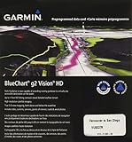
 Garmin BlueChart g2 Vision Vancouver/San Diego Saltwater Map microSD CardGet a fresh perspective when you take to the water with BlueChart g2 Vision. With BlueChart g2 Vision data, you'll get detailed marine cartography that provides convenient viewing of nautical content and other premium features. BlueChart g2 Vision allows you to see your vessel's precise, on-chart po...$89.99$250.98
 -
Sale
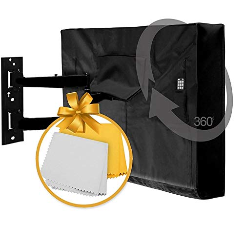 Outdoor TV Cover 40" - 42" - NOW WITH BOTTOM COVER, Quality Weatherproof and Dust-proof Material with FREE Microfiber Cloth. Protect Your TV Now!OUTDOOR TV COVER by CLICKS Ever experienced having wet or dusty TV or Monitors on your deck, patio, or poolside? Are you worried to take it outdoor due to fear of raindrops, dust, sun or snow? Fear No More! Clicks Outdoor TV Cover is finally here to the rescue! Why Choose the Outdoor TV Cover...$15.00$28.97
 -
Sale
 Navionics HMPT-S6: HOTMAPS PLATINM SOUTHHotMaps Platinum provides the most content so you can take full advantage of your chartplotters functionality. Dynamic 3D View allows you to customize exaggeration of key features and adjust pitch to highlight subtle depth changes or better visualize your approach through shallow or narrow channels....$167.66$199.00
 -
Sale
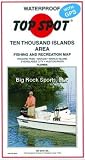
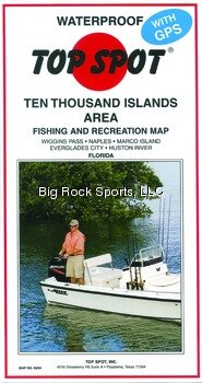 Top Spot Map N204 10 Thousand Islands Florida Area Fishing and Recreation MapThe Top Spot Map N204 10 Thousand Islands Florida Area Fishing and Recreation Map includes freshwater, inshore and offshore saltwater areas. Detailed information and GPS coordinates are provided for fishing locations, boat ramps, marinas and other points of interest.$22.98$27.48
 -
Sale
 Top Spot Map N207 Upper Keys AreaTop Spot Fishing Maps are waterproof and include freshwater, inshore saltwater and offshore saltwater areas. Detailed information and GPS coordinates are provided for fishing locations, boat ramps, marinas and other points of interest. ; Top Spot Map N-207, Florida ;Upper Keys Area - Florida Bay, Ba...$22.41$22.98
 -
Sale
 Top Spot Map N214 Jupiter-StuartTop Spot Fishing Maps are waterproof and include freshwater, inshore saltwater and offshore saltwater areas. Detailed information and GPS coordinates are provided for fishing locations, boat ramps, marinas and other points of interest. ; Top Spot Map N-214, Florida ;Jupiter to Stuart Area - Jupiter...$22.41$22.98
 -
Sale
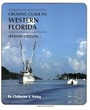
 Cruising Guides: Cruising Guide to Western Florida: Seventh Edition (Cruising Guide Series)Western Florida offers a tranquil alternative to the fastpaced lifestyle of the eastern coast, and Young leaves nothing unexplored in the waters from Flamingo to the Big Bend. This edition includes specific way points for anchorages and marinas as well as ratings and fees for transient dockage. Intr...$25.49$34.95
 -
Sale
 Top Spot Map N220 East FloridaTop Spot Fishing Maps are waterproof and include freshwater, inshore saltwater and offshore saltwater areas. Detailed information and GPS coordinates are provided for fishing locations, boat ramps, marinas and other points of interest. Top Spot Map N-220, Florida. Atlantic Ocean East Florida Offshor...$22.98$27.48
 -
Sale
 Top Spot Map N211 Miami AreaTop Spot Fishing Maps are waterproof and include freshwater, inshore saltwater and offshore saltwater areas. Detailed information and GPS coordinates are provided for fishing locations, boat ramps, marinas and other points of interest. Top Spot Map N-211, Florida Miami Area - Biscayne Bay, Miami, Mi...$22.41$22.98
 -
Sale
 GARMIN VUS011R SOUTHWEST FLORIDA BLUECHART G2 VISION GARMIN VUS011R SOUTHWEST FLORIDA BLUECHART G2BlueChart® g2 Vision® HD - VUS011R - Southwest Florida - microSD™/SD™Coverage:Crystal River through Key Largo, including Tampa Bay, Ft. Myers, Lake Okeechobee, Florida Bay, Key West, and the Dry Tortugas.Premium Mapping and Graphics CapabilitiesDetailed nautical charts, in vector object oriented for...$199.99$321.42
 -
 Garmin BlueChart g2 Vision - VUS038R York - Chesapeake - microSD™/SD™ (35806)BlueChart® g2 Vision® HD - VUS038R - New York - Chesapeake - microSD™/SD™Coverage:Raritan Bay to Virginia Beach including Tarrytown, Fire Island Inlet, the entire New Jersey coastline, the C&D Canal, Delaware Bay, the Delaware River to Trenton, Chesapeake Bay, Baltimore, the Potomac River to Washing...$199.99
 -
Sale
 Mexico Boating Guide ( 3rd edition)This nautical guidebook for cruising boaters is updated to June 2018, so it's the most up to date. Contains 398 pages, 185 GPS charts, 450 color photos: written by professional mariners, experienced & active yacht cruisers. Mile by mile, no gaps: Mexico Boating Guide covers the outside of Baja, the...$59.46$69.95