


-
Sale
 Coastal NOAA Charts for Cruising Guide to Western FloridaBased on the National Oceanic and Atmospheric Administration charts, this companion to the Cruising Guide to Western Florida contains color navigational charts pertaining to the area. Not only does it give cruisers information on where to drop anchor, but also what to do once they abandon their sea...$51.21$65.00
 -
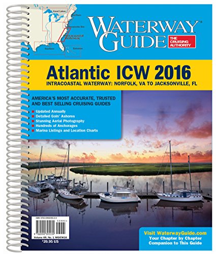 Waterway Guide Atlantic Icw 2016 (Waterway Guide. Intracoastal Waterway Edition)Updated annually, the Waterway Guide Atlantic ICW 2016 edition is the indispensable cruising companion for boaters exploring the Intracoastal Waterway from Norfolk, VA to the Florida border. The guide features mile-by-mile navigation information, aerial photography with marked routes, marina listing...$175.00$60.00
 -
Sale
 Understanding Weatherfax: A Guide to Forecasting the Weather from Radio and Internet Fax ChartsHow do you turn the symbols on a weather chart into a meaningful forecast? Armed with Understanding Weatherfax and a current weatherfax chart you have all of the essentials for making your own forecast, no matter where you are in the world.New to the Second Edition: Satellite images, interpreting ea...$13.28$19.95
 -
 Waterway Guide Chesapeake Bay 2015 (Dozier's Waterway Guide)Updated annually, the Waterway Guide Chesapeake Bay 2015 edition is the indispensable cruising companion for boaters exploring the Chesapeake Bay, the Delaware Bay and the Delmarva Atlantic coast from Cape May to Norfolk. The guide features mile-by-mile navigation information, aerial photography wit...$175.00$39.95
 -
Sale
 Radar - Made Simple for Cruisers: Handbook for Starting the Dream"Radar Made Simple for Cruisers" 2nd Edition continues enhancing basic radar operation and adds radar interference and a some new trick for single handing cruisers. The original focus on how a cruiser, or especially a single handing cruiser, might best use their radar to remain safe and sane remains...$19.36$29.50
 -
 Sam Rayburn Reservoir, Texas Enlarged Version Geographic GPS Charts and Above Water and Underwater Topography.Sam Rayburn Reservior, Texas ENLARGED VERSION GEOGRAPHIC GPS CHARTS AND ABOVE WATER AND UNDERWATER TOPOGRAPHY. GPS COORDINATES FOR UNDERWATER STRUCTURES. Coordinates for 285 locations. Fish habitat and Fish Shelters vary per each lake. Coordinates for locations vary per each map. Waterproof Ma...$18.00$18.00
 -
 Windward AnchoragesWindward Anchorages graphically, and through spectacular aerial photography, depicts 47 anchorages and harbors throughout the islands of Martinique, St. Lucia, St. Vincent, Grenadines and Grenada, from St. Pierre, Martinique to St. David's Harbour, Grenada. The book is to be used in conjunction with...$95.91$29.95
 -
 Leeward AnchoragesLeeward Anchorages, graphically, and through spectacular aerial photography, depicts 43 anchorages and harbors throughout the islands of Anguilla, Sint Maarten/Saint Martin, Saint Barts, Saba, Statia, Saint Kitts, Nevis, Barbuda, Antigua, Guadeloupe, Marie Galante, Iles des Saintes and Dominica from...$89.00$29.95
 -
Sale
 Cruising Atlas for Northwest WatersIt's like having eight atlases in one! This large scale, large coverage atlas contains the reproduction of government charts covering from Olympia, WA, to Queen Charlotte Sound (following the inside passage on the east side of Vancouver Island). It consists of 88 overview charts and 86 detailed char...$47.99$54.80
 -
 Waterway Guide Southern 2014Updated annually, the Waterway Guide Southern 2014 edition is the indispensable cruising companion for boaters exploring Florida's East coast, the St. John's River, the Okeechobee Waterway, the Keys, Florida's West coast and the Gulf of Mexico to Brownville, Texas. The guide features mile-by-mile na...$175.00$39.95
 -
 The Basics of Rebreather DivingProfessional rebreather diving instructor Jill Heinerth helps divers navigate the complex, and sometimes intimidating world of rebreather diving. Providing clear, candid and straightforward information based on her decades of exploration and teaching experience, Jill leads readers through the histor...$159.34
 -
 2015 Yachtsman's Guide to the BahamasThe Yachtsman's Guide to the Bahamas continues to be the very first and number one all time best selling All Bahamas Cruising Guide published. This Guide has been updated every year since 1950 and has the distinction of being considered by the boating community the definitive Bahamas Cruising Guide...$155.00