


-
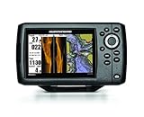
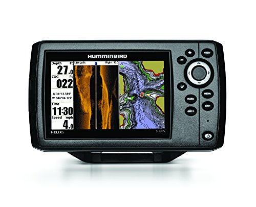 Humminbird 409640-1 HELIX 5 SI Fish Finder with Side-Imaging and GPSThe Humminbird 409640-1 HELIX 5 SI/GPS Combo features a brilliant 800H x 480V, 5" 256 color display with backlight. Side Imaging/Down Imaging and Dual Beam Plus sonar with 4000 watts PTP power output, Precision Internal GPS Chartplotting with built-in UniMap cartography with a micro SD card slot for...$552.45$499.99
 -
Sale
 Lowrance 000-12178-001 Elite-9 Fishfinder/Chartplotter with Navionics+, 50/200KHz CHIRP and 455/800KHz DownScan TransducerLowrance Elite-9 CHIRP Fishfinder/Chartplotter. 9" Widescreen Color LCD with Navionics Gold Charts for the U.S. and Canada. Includes 50/200KHz CHIRP and 455/800KHz DownScan Imaging transducer. All-NEW, easy-to-use, 9-inch fishfinder/chartplotter combines CHIRP Sonar with DownScan Imaging technology,...$1306.27$1499.00
 -
Sale
 Humminbird Electronic Chart AutoChart ProOver 140,000 named water bodies and over 1.75 million unnamed water bodies- Canada: Over 96,000 named water bodies and over 3.85 million unnamed water bodies - Detailed Coastal shoreline for United States - Create your own detailed shoreline using aerial imagery within AutoChart PRO PC- 32 GB SD car...See At Checkout$249.99
 -
 Humminbird 600025-4 Electronic Charts WisconsinWith state-of-the-art mapping technology paired with the most accurate lake data available, you can stop wandering around the lake. Imagine finding a hot spot and in seconds your computer identifies all other areas of the lake with similar characteristics. Just enter a species, time of year, and tim...$220.99$124.95
 -
 Navionics HotMaps Premium South U.S. Two-Dimensional Lake Maps on SD CardNavionics Hot Maps Premium South U.S., two-dimensional lake maps on SD card. Hot Maps Premium leads the way to fish. Whether you are a tournament angler or relaxing on a weekend, you can study patterns and eliminate unproductive water to target the most successful areas. With the latest content on u...$361.92
 -
 C-MAP 4D Full Central America & Caribbean SD/MSD CardC-Map 4D full option, Mfg# na-d027, central America & Caribbean on SD/MSD card. Includes Vector charts, Port info, tides & currents, aerial photos, roads, elevations, perspective view. With satellite imagery, 3D viewing, and raster charts.$290.41$290.41
 -
 Humminbird LakeMaster Chart - Great Plains - MicroSD/SD (56242)LakeMaster Chart - Great Plains - MicroSD/SDThe Humminbird LakeMaster Great Plains Edition, Version 5 Map Card combines many of the best fishing waters for Iowa, Illinois, Kansas, Missouri, and Nebraska all on one map card.The Great Plains Version 5 map card is i-Pilot® Link&153; compatible. Version...$238.41
