


-
 Waterway Guide Chesapeake Bay 2015 (Dozier's Waterway Guide)Updated annually, the Waterway Guide Chesapeake Bay 2015 edition is the indispensable cruising companion for boaters exploring the Chesapeake Bay, the Delaware Bay and the Delmarva Atlantic coast from Cape May to Norfolk. The guide features mile-by-mile navigation information, aerial photography wit...$175.00$39.95
 -
 Sam Rayburn Reservoir, Texas Enlarged Version Geographic GPS Charts and Above Water and Underwater Topography.Sam Rayburn Reservior, Texas ENLARGED VERSION GEOGRAPHIC GPS CHARTS AND ABOVE WATER AND UNDERWATER TOPOGRAPHY. GPS COORDINATES FOR UNDERWATER STRUCTURES. Coordinates for 285 locations. Fish habitat and Fish Shelters vary per each lake. Coordinates for locations vary per each map. Waterproof Ma...$18.00$18.00
 -
 Waterway Guide Southern 2014Updated annually, the Waterway Guide Southern 2014 edition is the indispensable cruising companion for boaters exploring Florida's East coast, the St. John's River, the Okeechobee Waterway, the Keys, Florida's West coast and the Gulf of Mexico to Brownville, Texas. The guide features mile-by-mile na...$175.00$39.95
 -
 Exploring the San Juan & Gulf Islands: Cruising Paradise of the Pacific NorthwestThe latest book in the cruising guide series, Exploring the San Juan and Gulf Islands explores the most scenic and accessible cruising ground in the world--with well-sheltered waters, comfortable resorts, quaint villages and secure anchorages. The colorful San Juan and Gulf Islands, a seventy-mile c...$69.99$49.95
 -
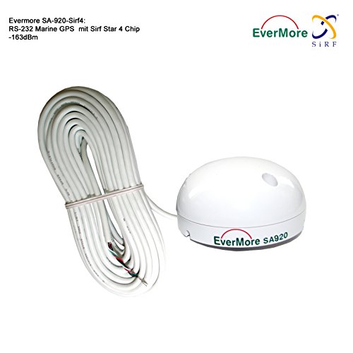 48 channel - high sensibility -163dBm Marine GPS Receiver Evermore SA-920 with Sirf Star 4 Chip: High End Receiver for Boat Ship - usable w Plotter, Radio, Fishfinder.. over RS-232 Interface. Antenna aerial for precise Marine Navigation with Sirf IV ChipMarine GPS Receiver SA-920 with Sirfstar 4 Chip: High End GPS Receiver for Boat, Ship - Usable with Plotter, Radio, Fishfinder, etc over RS-232 Interface*. . Overview: Output Lat/Lon, Time, Speed, Course & Satellite Data in standard NMEA protocol and at RS232 level which can be linked directly to ma...$140.00$140.00
 -
Sale
 Tacktick T122 NMEA InterfaceT122 Micronet Wireless NMEA InterfaceKey FeaturesOnly 135g (0.3lbs) 9 - 24 V external power supply NMEA 0183 Ver 2.3 2 inputs and 1 output External Alarm connectorProduct DescriptionThis interface enables sailors to integrate other marine electronics into any of the Micronet instrument range. Compat...$357.13$359.85
 -
 Florida Keys and Everglades Cruising GuideOne of the most complete guides ever written to this popular cruising area, 256 pages, 129 photos, 56 sketch charts, street maps, GPS waypoints and course lines to aid in navigation, covering Biscayne Bay, Hawk Channel, the shallow inside route, including the area from Miami to Key West and on to th...$32.95$32.95
 -
 SI-TEX SVS-880C 8" Chartplotter w/Internal GPS Antenna & Navionics CardThe Amazing Quality SVS-880C 8" Chartplotter w/Internal GPS Antenna & Navionics+ Card The SI-TEX SVS-880C is a powerful big-screen performer designed to fit every boat and budget. This compact chartplotter and chartplotter/sonar system delivers the goods for any vessel, from center console skiffs to...$920.02$920.02