


-
Sale
 Garmin echoMAP 50s GPS without Transducer, Preloaded with Worldwide Basemap and US BlueChart g2 Offshore ChartsAn Amazing Combo with a 5" Display 5" VGA display HD-ID™ sonar 500W (77/200 kHz) transducer 10Hz GPS/GLONASS receiver Wireless connectivity echoMAP 50s is an amazing chartplotter and fishfinder combination. Its crystal-clear 5" display provides clear target separation, allows visibility both...$549.00$549.99
 -
 Garmin Echo Map 70Dv Worldwide with Transducer (Discontinued by Manufacturer)An Amazing Combo with a 7" Touchscreen Display 7" WVGA touchscreen display with pinch-to-zoom HD-ID™ sonar 500W (77/200 kHz) transducer 10Hz GPS/GLONASS receiver Wireless connectivity echoMAP 70s is an amazing chartplotter and fishfinder combination, featuring a 7" WVGA touchscreen display with...$1250.00$1099.99
 -
Sale
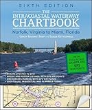
 Intracoastal Waterway Chartbook Norfolk to Miami, 6th Edition (Intracoastal Waterway Chartbook: Norfolk, Virginia to Miami, Florida)$500 WORTH OF GOVERNMENT CHART AND COAST PILOT COVERAGE--MARKED WITH WAYPOINTS, BRIDGES, AND THE ROUTE! The Intracoastal Waterway Chartbook is a complete set of navigation charts for the 1,090-mile Intracoastal Waterway from Norfolk to Miami, as well as charts for all major Atlantic inlets. The char...$43.51$78.00
 -
 Garmin GPSMAP 531s 5-Inch Waterproof Marine GPS and Chartplotter with SounderGPSMAP 531 Series GPS Receiver (GPSMAP 531S; With dual-beam transducer)$799.00$599.99
 -
 Garmin GPSMAP 547 10Hz GPS/GLONASS ReceiverAn Amazing Chartplotter 5" VGA display 10 Hz GPS/GLONASS receiver Wireless connectivity U.S. coastal and inland mapping GPSMAP 547 allows for easy visibility, day or night. Whether it is flat, flush or swivel-mounted, it will be the focal point of your helm. It includes our hallmark user-friendl...$749.99$749.99
 -
Sale
 The Northern Bahamas Cruising Guide Volume 1From Grand Bahama and the Abacos South to Cat Island Completely updated 2013 Edition of the Pavlidis Bahamas Guides All Original Charts Based on Personal Surveys Conducted by the Author Extensive Navigational Instructions and GPS Waypoints New Full-color Aerial Photos and Charts Coverage Includ...$46.31$64.95
 -
 Garmin GPSMAP 431 GPS ChartplotterThe Garmin GPSMAP 431 Compact Chartplotter with U.S. Inland Lake Maps features an ultra-bright 4 inch QVGA color display along with an improved high-speed digital design for increased map drawing and panning speeds. It's ready to go with a built-in, satellite-enhanced basemap preloaded with U.S. Inl...$999.00$399.99
 -
Sale
 Raymarine e127 12.5-Inch Touchscreen Multi-Function Display/Fishfinder with Lighthouse US Coastal ChartsRay marine e127 12.5" Touchscreen Multi-Function Display/Fish finder w/Lighthouse US coastal charts. Ray marine's Hybrid Touch displays allow simple touch screen control, or you can take command with the rotary Unicontroller and keypad - the choice is yours. These units feature sunlight viewable, op...See At Checkout$2999.99
 -
 Chapman Piloting & Seamanship 67th Edition (Chapman Piloting and Seamanship)More than ever, boaters need a single comprehensive reference that combines the best traditions of seamanship with cutting-edge practices, gear, and technology. That's why, for nearly a century, Chapman Piloting & Seamanship has remained the most respected and widely used guide for boating under pow...$78.67$60.00
 -
 Garmin GPSMAP 4010 10.4-Inch Waterproof Marine GPS and Chartplotter (Discontinued by Manufacturer)This mid-sized 4000 series chartplotter fills the gap between the smaller GPSMAP 4008 and the wider GPSMAP 4012. Like its counterparts, the 4010 serves as your all-in-one nerve center for the Garmin Marine Network. This chartplotter has crisp, video-quality resolution on a 10.4" (26.4 cm) diago...$3284.67$2199.99
 -
Sale
 Cruising the Chesapeake: A Gunkholers Guide, 4th Edition"Shellenberger has perfected the art of gunkholing . . . An excellent book for both those who enjoy weekend cruises and those who merely want to know more about Chesapeake Bay." -- Daily Press (Newport News, VA) "With more than 3,000 miles of shoreline, the Chesapeake Bay offers a treasury of cruisi...$19.80$48.00
 -
Sale
 Mexico Boating Guide ( 3rd edition)This nautical guidebook for cruising boaters is updated to June 2018, so it's the most up to date. Contains 398 pages, 185 GPS charts, 450 color photos: written by professional mariners, experienced & active yacht cruisers. Mile by mile, no gaps: Mexico Boating Guide covers the outside of Baja, the...$59.46$69.95


