


-
Sale
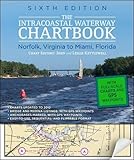
 Intracoastal Waterway Chartbook Norfolk to Miami, 6th Edition (Intracoastal Waterway Chartbook: Norfolk, Virginia to Miami, Florida)$500 WORTH OF GOVERNMENT CHART AND COAST PILOT COVERAGE--MARKED WITH WAYPOINTS, BRIDGES, AND THE ROUTE! The Intracoastal Waterway Chartbook is a complete set of navigation charts for the 1,090-mile Intracoastal Waterway from Norfolk to Miami, as well as charts for all major Atlantic inlets. The char...$43.51$78.00
 -
 Lowrance Lake Insight PRO v14 U.S. Inland Lake ChartsLowrance Lake Insight PRO v14 U.S. Inland Lake Charts. Features total coverage of inland lakes for the contiguous 48 states. For use in HDS GEN2 Touch, HDS GEN2, Mark HDI, Elite HDI, Mark And Elite units. It features U.S. inland lake coverage, including the Great Lakes with detailed fishing and navi...$104.44$99.00
 -
 Garmin GPSMAP 431S GPS Dual Beam ComboULTRA-BRIGHT 4" DIAGONAL QVGA DISPLAY240 X 320 PIXELS MORE THAN 800 NITS OF BRIGHTNESSPRELOADED WITH CHARTS FOR MORE THAN 14000 US LAKES & NAVIGABLE RIVERSBUILT-IN HIGH-SENSITIVITY GPS RECEIVERHIGH-SPEED PROCESSOR FOR FAST SCREEN REDRAWS & SMOOTH PANNING2 NMEA 0183 I/O PORTSSTREAMLINED USER INTERFAC...$899.00$449.99
 -
Sale
 The Northern Bahamas Cruising Guide Volume 1From Grand Bahama and the Abacos South to Cat Island Completely updated 2013 Edition of the Pavlidis Bahamas Guides All Original Charts Based on Personal Surveys Conducted by the Author Extensive Navigational Instructions and GPS Waypoints New Full-color Aerial Photos and Charts Coverage Includ...$46.31$64.95
 -
Sale
 WEEMS & PLATH Marine Navigation Parallel PlotterOur most popular plotter! This instrument consists of a plotter mounted on a roller. The plotter contains distance scales at 1:20,000, 1:40,000, and 1:80,000 to fit the N.O.S. Coast and Harbor Charts, as well as an inch scale. Included are a semi-circular$25.99$27.99
 -
Sale
 GARMIN VUS011R SOUTHWEST FLORIDA BLUECHART G2 VISION GARMIN VUS011R SOUTHWEST FLORIDA BLUECHART G2BlueChart® g2 Vision® HD - VUS011R - Southwest Florida - microSD™/SD™Coverage:Crystal River through Key Largo, including Tampa Bay, Ft. Myers, Lake Okeechobee, Florida Bay, Key West, and the Dry Tortugas.Premium Mapping and Graphics CapabilitiesDetailed nautical charts, in vector object oriented for...$199.99$321.42
 -
 Garmin BlueChart g2 Vision - VUS038R York - Chesapeake - microSD™/SD™ (35806)BlueChart® g2 Vision® HD - VUS038R - New York - Chesapeake - microSD™/SD™Coverage:Raritan Bay to Virginia Beach including Tarrytown, Fire Island Inlet, the entire New Jersey coastline, the C&D Canal, Delaware Bay, the Delaware River to Trenton, Chesapeake Bay, Baltimore, the Potomac River to Washing...$199.99
 -
Sale
 Rudow's Guide to Fishing the ChesapeakeRudow's Guide to Fishing the Chesapeake is the most comprehensive handbook for anglers on all of the Chesapeake's waters from main-stem bay to tributaries and tidal creeks. Detailed charts feature over 550 boating hot spots and 35 public shoreline fishing spots, plus 33 reliable public boat ramps. S...$5.00$14.50
 -
Sale
 Raymarine e127 12.5-Inch Touchscreen Multi-Function Display/Fishfinder with Lighthouse US Coastal ChartsRay marine e127 12.5" Touchscreen Multi-Function Display/Fish finder w/Lighthouse US coastal charts. Ray marine's Hybrid Touch displays allow simple touch screen control, or you can take command with the rotary Unicontroller and keypad - the choice is yours. These units feature sunlight viewable, op...See At Checkout$2999.99
 -
 Chapman Piloting & Seamanship 67th Edition (Chapman Piloting and Seamanship)More than ever, boaters need a single comprehensive reference that combines the best traditions of seamanship with cutting-edge practices, gear, and technology. That's why, for nearly a century, Chapman Piloting & Seamanship has remained the most respected and widely used guide for boating under pow...$78.67$60.00
 -
 Garmin GPSMAP 4010 10.4-Inch Waterproof Marine GPS and Chartplotter (Discontinued by Manufacturer)This mid-sized 4000 series chartplotter fills the gap between the smaller GPSMAP 4008 and the wider GPSMAP 4012. Like its counterparts, the 4010 serves as your all-in-one nerve center for the Garmin Marine Network. This chartplotter has crisp, video-quality resolution on a 10.4" (26.4 cm) diago...$3284.67$2199.99
 -
Sale
 Cruising the Chesapeake: A Gunkholers Guide, 4th Edition"Shellenberger has perfected the art of gunkholing . . . An excellent book for both those who enjoy weekend cruises and those who merely want to know more about Chesapeake Bay." -- Daily Press (Newport News, VA) "With more than 3,000 miles of shoreline, the Chesapeake Bay offers a treasury of cruisi...$19.80$48.00


